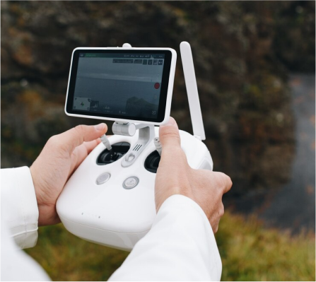
Airspace Monitoring
It enables users or customers to monitor airspace, such as no-fly zones, restricted areas, weather conditions, and more live updates.
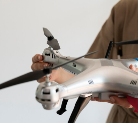
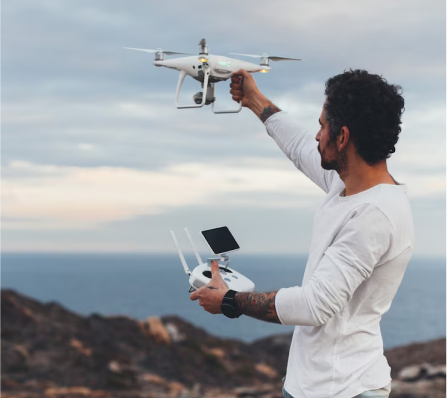
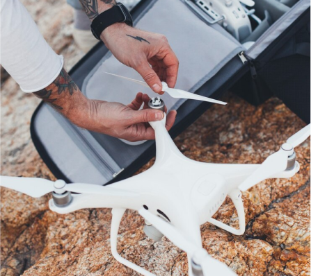
Modern drone tech demands smarter software. Our solutions power surveillance, agriculture, delivery, mapping, aerial analytics, and industrial drone applications.
Share your drone automation, mapping, fleet, or analytics requirements.
Make an online live streaming app from start to broadcast and organize your real-time video. Based on your business goals, we connect with the best platforms for video streaming and find the best solutions for you.
It enables users or customers to monitor airspace, such as no-fly zones, restricted areas, weather conditions, and more live updates.
This feature allows users or pilots to track their flights in real-time, and it can enhance operational efficiency.
It can analyze the flight?s data, such as general information, battery status, speed, and other useful data insights for better decision-making.
The drone software sends alerts regarding any instant updates and maintenance requirements.
This feature allows users to integrate with third-party tools and software for better mapping, monitoring, and access to advanced functions.
If users have any issues regarding the drone services, then they can consult with the customer support team to solve their issues and concerns.
The drone software has secure data storage facilities, and it can also store the data in a huge cloud storage.
There are various drone software development services that can enhance the client?s experience and enable the development of successful software.
Drone Service
The Custom drone software services help clients create software according to their requirements and flexibility. Clients or businesses can integrate their custom functionalities and features, which can lead to unique development compared to others. So, developing custom drone software can be a turning point for businesses.
The custom drone software allows clients to integrate their specific features and functions and design the software as per their demands.
This flight control software allows pilots to control flight activities such as speed, navigation, stability, and more.
It can easily manage multiple drones and flights to enhance their coordination and provide detailed information about takeoff and landing.
This software solution enables clients to monitor or control the flight remotely and access instant updates via cloud services.
The Navigate software solution enables flight navigation via GPS integrations, and clients can also track flights using AI and sensors.
It mainly provides for specific industries such as construction, mining, and agriculture. It enables clients to map and survey industries through drone activities.
There are many challenges faced during the drone software development solutions and many opportunities that can lead to the project?s success. Our mobile app development company in UAE offers the challenges and opportunities in detail and clear the client?s confusion.

Data security can be one of the common challenges during overall development because drone software collects huge amounts of sensitive data. It includes various challenges, such as unauthorized access to sensitive data and preventing the data from malware.

In drone software, hardware integration is a must to perform advanced features such as recording the mapping and tracking in real time. It involves many hardware equipment such as sensors, motors, and GPS.

For long flights, tracking the drone's battery is one of the most common challenges. There must be a power consumption to save the battery life. A problem occurs when tracking the flights at the last moment and the drone's battery is over.

Data insights can be an opportunity. They observe the details of flight timings, agriculture reports, and various industries. They allow businesses to identify new areas for improvement and enhance the capture of details.

The drone software can track environmental areas such as wildlife and forest areas, monitor air quality, and observe climate change information. This can enhance the experience of wildlife photographers by allowing them to observe every side of the forest.

This opportunity provides faster access to real-time data, and it can reduce the slower speed times. The 5G connectivity offers real-time communication faster as compared to other network connections, and clients can easily track the details.
The drone software development process starts from identifying the basic requirements to launching the software on a live phase.
Our drone software development company in UAE has completed thousands of successful projects and has connections with reputed clients worldwide. We, an Android app development company, mainly focus on completing the work before the deadline with quality work.
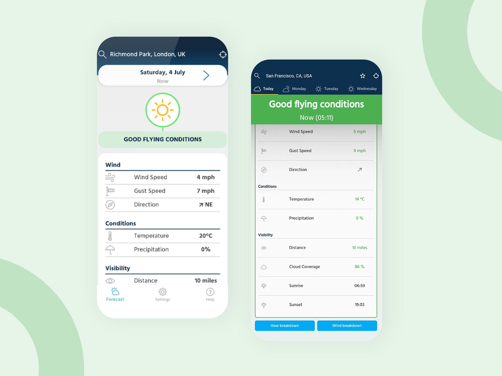
We provide the best hyperlocal weather forecasts, no fly zones, in a simple to use interface. This app is suitable for all drone models including DJI, Parrot, Ryze and many more!...
Learn more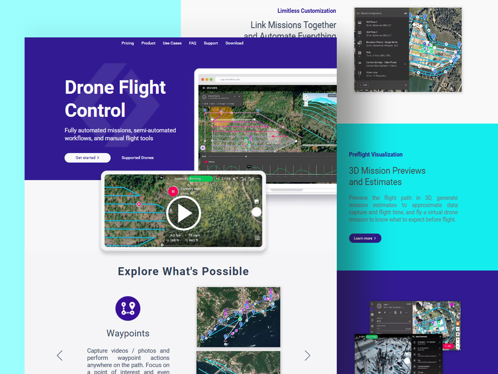
Fly missions for maps, waypoints, orbits, panos, vertical mapping, or inspections. Use flight modes such as orbit, follow, or focus. Link missions together, automate everything, and preview in 3D.
Learn moreBuild range
$8K - $25K
Maintenance
15% - 20%
 Build Estimate
Starting range
$8,000 - $25,000
The drone software development cost is around $8,000 to $25,000 or more, depending on the various factors, and that can fluctuate the development cost.
Get a Cost Estimate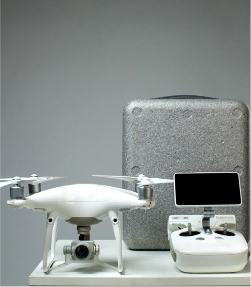 Support Plan
Annual range
15% - 20%
The maintenance cost of drone software lies between 15% and 20% of the overall software development cost. It includes updating outdated features, fixing bugs and glitches, adding new features, monitoring performance, and more.
There are various high-tech tools and technologies to build successful drone software, and these technologies can be preferred for futuristic features and functions.


We focus on developing software for drone control, mapping, and analysis for industries in the UAE.

After 15 years of developing drone technology we provide advanced drone capabilities for the logistics sector, agricultural sector, and defense industries.

Our drone applications incorporate Geographic Information Systems (GIS) and Artificial Intelligence (AI) analytics to create mapping, tracking, and reporting capabilities with high precision.

We develop software in compliance with UAE aviation regulations and safety measures ensuring that drones can be operated safely.

We develop cost effective software options for drones that have all the features needed to ensure the highest value and capability that meets corporate budget requirements.

Be the king-size travel agency by offering new-age solutions.
Optimize fleet, route and delivery operations.
Request a FREE Quote to avail our mobile & web development services

Business success is impossible without Client Satisfaction. We work to keep our clients happy and satisfied. Look at what our clients have to say about our web and mobile app development services.
View More
Zaynab
DubaiHappy to avail mobile app development services from Dev Technosys. This organization has the best team of professionals who have helped me throughout the app development period. Also, I got my project within the deadline. The prices were reasonable enough. Would love to recommend this organization for development.

Khalid Khan
Abu DhabiBeing a newbie to this business world, developing an app was challenging for me. At that time, I got in touch with Dev Technosys professionals. Their professionals not only helped to bring my business idea into reality but also developed a perfect app for my food delivery business. Satisfied with the food app development services and prices too.

Javed Ali
RuwaisI started my business application developed with one of the app development companies in Florida, but the outcomes were not satisfactory. So, I started looking for another organization and got to know about Dev Technosys. The mobile app developers helped me amazingly develop the perfect application that I was looking for. Dev Technosys is my recommendation for anyone looking to develop high-quality apps, websites, or software.

Sameh Saeed
FujairahI'd want to express my gratitude to everyone at Dev Technosys who has contributed to the project. The efforts made by the team helped me accomplish milestones. All of them have been quite helpful throughout the process. Looking forward to connecting for the new initiative in the future! Also, I would like to recommend businesses seek development assistance from them.

Alifya
KalbaWhen I started my business, I wasn’t sure about the mobile app development process, but Dev Technosys, UAE, helped me with it. Their support and transparent communication helped me stay updated about my business application status. The outcome was quite impressive, and the app development cost was reasonable enough. Overall, it was a good experience getting in touch with Dev Technosys.

Alanood Hussain
DubaiDev Technosys developers did a mind-blowing job while working on android app development. Without a doubt, I can recommend this organization to anyone for their next project. From my business app idea analysis to development & testing, everything was carried out perfectly. The best part was that the team constantly updated me about the project status. Good job!

Halum
Al MushrifI needed a taxi booking app urgently, and the deadline was too short, but Dev Technosys accomplished it. The experts successfully delivered the project within the promised date. I wasn’t expecting it, but they did a great job. Although the prices were quite high, the outcome was promising, so paying a little extra wasn’t a concern anymore. Must-recommended organization!

Tahir Ahmed
BahlaI had a business app idea but didn’t have the right team and tools to bring it to reality. Then I took development services from Dev Technosys. The team helped me with the development, designing, and planning process. Everything went well as planned, and finally, I got a perfect app in hand. All credit goes to the talented and skilled professionals of Dev. Happy with the services and highly recommend the company to everyone.

Saheb Shah
AI HamraDev Technosys is a great platform to avail mobile & web development assistance. I have services from this company and got a perfect outcome as expected. Undoubtedly, there were some glitches, but then the team resolved them with proper communication. Other than this, everything went perfectly, including the development, pricing, and testing of the app. Five stars to this company from my side!

Amatullah
BarkaIn the beginning, I was a little unsure of my decision to choose Dev Technosys, but the team proved me wrong. The project they delivered was exactly what I was expecting. The best thing was that the professionals tried to cover everything under my budget and that too, without compromising the quality. I also availed app maintenance services from this organization, and it was worth it.

Hareb Shaikh
Abu DhabiWhen I consulted the professionals of Dev Technosys, half of my business app was already developed, which was not perfect. So, the developers helped me complete the app development process with perfection and delivered it timely. I am very grateful to the Dev team for their impeccable support and assistance. Would highly recommend this organization for both app & web development.

Kashif Hassan
SilaWorking with Dev Technosys was a great experience despite my initial hesitation to avail development assistance remotely. The team has great potential. They adhered to all my business requirements and offered me exactly what I needed. Things couldn’t have been this better without the assistance of Dev’s team. Thank you for the support and amazing services!
Schedule a FREE 30-minute consultation with our experts.
★★★★★
★★★★★
★★★★★
★★★★★
Let's build something amazing together!
"Happy to avail mobile app development services from Dev Technosys. This organization has the best team of professionals who have helped me throughout the app development period."
Dubai
"I started my business application developed with one of the app development companies in Florida, but the outcomes were not satisfactory."
Ruwais
"Being a newbie to this business world, developing an app was challenging for me. At that time, I got in touch with Dev Technosys professionals."
Abu Dhabi
"I'd want to express my gratitude to everyone at Dev Technosys who has contributed to the project. The efforts made by the team helped me accomplish milestones."
Fujairah
"When I started my business, I wasn’t sure about the mobile app development process, but Dev Technosys, UAE, helped me with it. "
Kalba
"Dev Technosys developers did a mind-blowing job while working on android app development. Without a doubt, I can recommend this organization to anyone for their next project."
Dubai